Trip report · Mount Whitney Trail · October 29, 2023
Mount Whitney
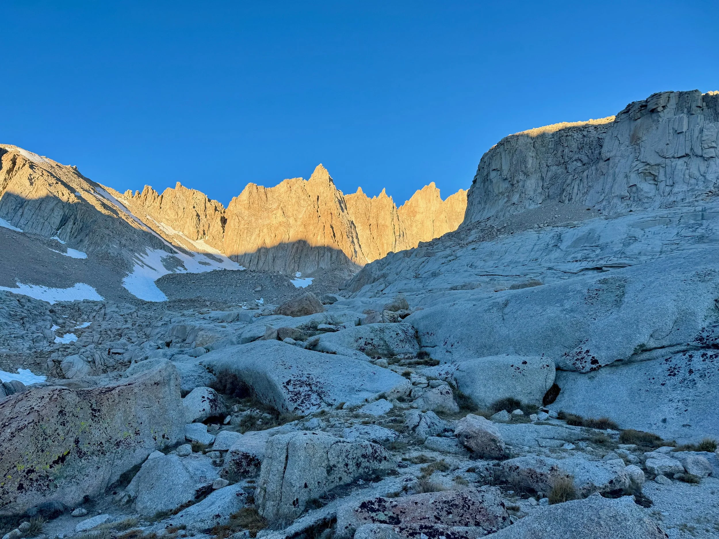
Oh, Mount Whitney... there is much to say about the Big Enchilada, the crown jewel of the Sierra (okay fine maybe that’s North Palisade), the famed tallest peak in the “lower 48” (isn’t Hawai’i lower though? I digress). It’s interesting that we hold this mountain in such high esteem due to an arbitrary elevation that doesn’t exactly put other fourteeners to shame – it is a mere 100 or so feet taller than Colorado’s Mt. Elbert, which draws only a fraction of the crowds and fanfare – so much so that our species went through the trouble of constructing an 11-mile trail from Whitney Portal to the summit. Technical routes on the peak abound, but the trip report you’re about to read concerns the aforementioned class 1 slog. And so it goes:
I had always wanted to stand on the summit of Whitney for that arbitrary yet very real achievement of bagging the tallest peak in the contiguous US. It always felt like a rite of passage not even as a climber or mountaineer, but as just a plain old hiker in California. Year after year, I was denied a permit only to see wannabe Instagram influencers embarrassing themselves on the trail via social media. I decided to table it in favor of other high peaks, but when I saw a cancellation pop up in October, I couldn’t resist the opportunity and snagged the permits for me and my partner along with a Whitney Portal campsite. Fresh off an August peakbagging rampage through the Colorado Rockies and an exhilarating climb of Cloudripper’s west chute the weekend prior, we drove up to Lone Pine on October 28 and did a short acclimatization hike from the Horseshoe Meadows trailhead before heading to the portal, setting up camp, and fueling ourselves with freeze-dried beef stroganoff and store-bought blueberry pie by the campfire. I observed a group of men about my age at a campsite down the hill spend several hours chopping wood like video game NPCs – interesting survival instincts at a developed campground with firewood, bathrooms, plus a restaurant and souvenir shop. There was another group of gentlemen chugging beers well into the evening, none of whom seemed to materialize anywhere on the trail the next day. Despite our neighbors’ shenanigans, the campground was a nice place to catch some rest before our alpine start the next day.
I woke up before my 2:00 AM alarm the morning of October 29, the adrenaline already coursing through my veins. Never one to sacrifice a solid morning routine, I spent a while getting ready and milling about before we threw on our packs, extended our trekking poles, and began hiking through the dark from our campsite to the trailhead, which added about a mile each way. Given our start time of 3:14 AM, I figured we’d be back to the trailhead with some daylight left. Boy, was I wrong (more on that later). The ascent began immediately as we navigated the subalpine switchbacks with the aid of our headlamps. We had hiked the portion of the trail to Lone Pine Lake that Labor Day weekend, and were surprised to find that the stream crossing we recalled was now frozen over. That would be the first of many obstacles on this “walk-up” trail. We made it across and continued up and onward. We passed a few people who completely lacked trail etiquette (I guess you can’t buy that at REI) and were sitting directly in the middle of the trail with their gear strewn about. And the herd was already thinning as other hikers began to abandon the climb (making them much smarter than me), while others were showing signs of distress. We found one man who was in no distress whatsoever, which made him an absolute delight to talk to, and chatted with him for a while as we all hiked together. We all stopped at Trail Camp to fill up water at the lake, where our new trail buddy encouraged me to forego filtering my water. I politely declined given my difficulty digesting literally anything, to which I felt dysentery would likely be no exception. We filtered the water, which was quite refreshing for the short duration it remained liquid.
We then proceeded to the 99 switchbacks, which weren’t too bad because I didn’t even realize we were on them until midway up. What was bad, however, was the “cables” section which was covered in ice due to the harsh winter and how late we were in the season. We put on microspikes and carefully made our way through the section, which felt longer than it was. At this point, the crowd on the mountain began to diminish considerably. Our trail buddy even had to turn around because his friend was exhibiting symptoms of altitude sickness (I didn’t realize he had a friend with him the entire time). So now it was the few, the proud, the chosen ones who would continue on to the summit of Mount Whitney.
Things started to get weird at Trail Crest. On one hand, the scenery finally opened up, revealing the expansive and gorgeous views of the Sierra Crest, Kings Canyon, and numerous alpine lakes. On the other hand, it was -7 degrees with the wind chill and our water froze. Nevertheless, I made sure to enjoy the scenery and take lots of photos along this section. But we were really starting to slow down and get uncomfortable due to the conditions despite being appropriately dressed. It was just HARSH up there, man. We met a woman who had turned around just short of the summit due to the wind, which certainly planted a seed in my head, but not one I had any interest in watering and watching grow. We had read that the final part of the trail was covered in snow, requiring a scramble to bypass. We indeed found this to be the case, and with the hut in view, we tore through that boulder field and finally stepped onto the summit just after noon. We were one of only a few parties up there, which made sense given the utter insanity of hiking the trail that late in the season and during such an intense cold front. I Facetimed my parents who seemed proud yet concerned by how cold and tired I was. We didn’t linger up there long, and began our descent when I promptly sprained my right ankle. Then the fun really began.
I yelped, winced, and howled the entire way back down the mountain. This is probably a good time to mention that I hiked the entire way up with a broken toe on my left foot, so my spare limb wasn’t much help. Delirious from the altitude and exhaustion – but mostly from the excruciating pain – I got a little off-route descending the boulders and had to backtrack to find my way. Walking down on hard granite and ice didn’t do anything to ease the pain the rest of the way down, and at many points I used my trekking poles as crutches, slowing our pace considerably. It was no longer a matter of getting back at a respectable time; it was just a matter of getting back, period. I was under no delusions about my condition – I could get myself down (albeit slowly), I was physically fit, I had food and water, and, most importantly, I had a patient and supportive partner, so I never even considered calling SAR. This was a self-rescue, not an emergency. One of the few other parties on the summit offered first aid, but I declined. I was already popping ibuprofen and tylenol like pills at a warehouse rave, so I wasn’t sure what “first aid” would accomplish. In any event, we continued our descent at a slow yet steady pace and hardly noticed when nightfall swept the trail. After all, we’d begun our hike in the dark that morning. Lone Pine Lake, however, did seem to somehow get farther away, or so it felt. It took hours to reach our North Star there, and seemingly just as long to reach that frozen stream crossing. We made it back, walked down the road, and returned to camp around 8:30 PM. Exhausted and wondering why I didn’t use my generously unlimited PTO policy to request that Monday off, I hurriedly packed up, and we hit the road around 9:00, making it back to Los Angeles just in time to hit the In-N-Out drive-thru before it closed. A 3x3 animal style had never tasted so good.
The rest of my trip reports (and a full list of my ascents) are on Peakbagger. · Back to Field Notes